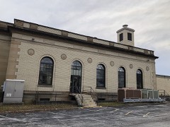
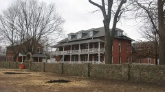
Listed on the National Register of Historic Places in
1982. A historic map-sheet match is not published yet. The record needs a coordinate-quality review before it can be joined to a sheet boundary.
From the record
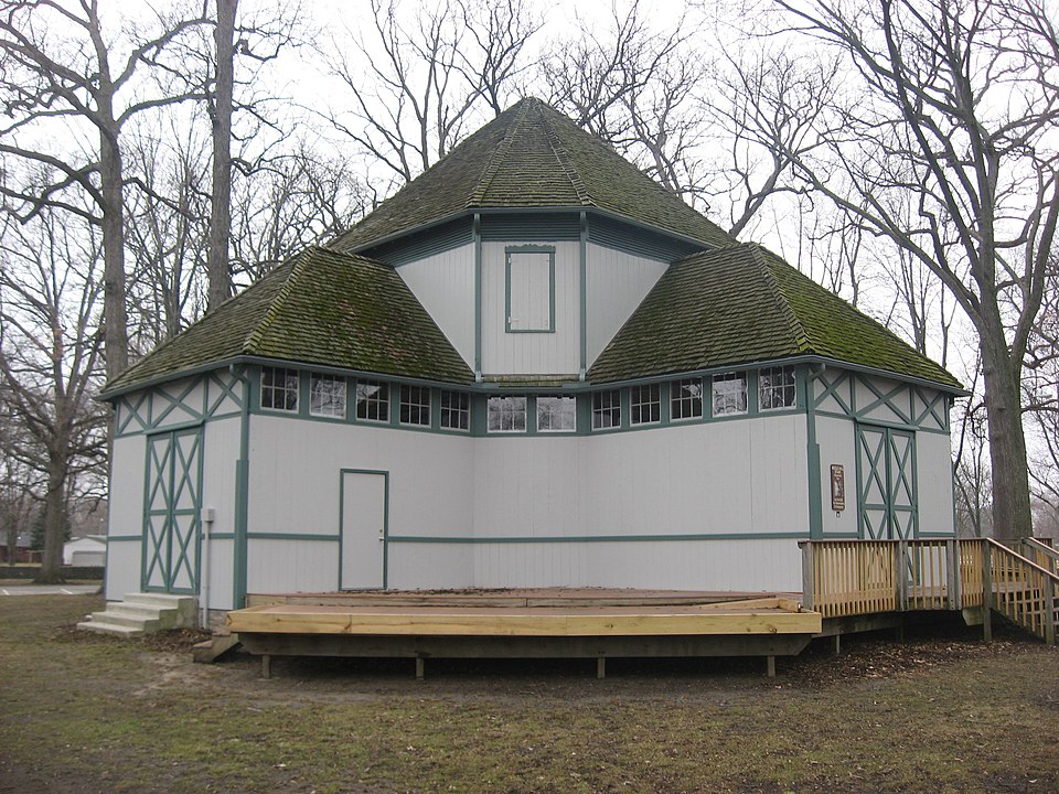
“The Floral Hall is a historic community building in the city of Bowling Green, Ohio, United States. Constructed in the 1880s for one of two competing county fairs, it is typical of exhibition buildings from the period.”
Wikipedia article Floral Hall (Bowling Green, Ohio), CC BY-SA 4.0.
one of 21 National Register listings in Wood County · listed in 1982 · category: Building · one of 1 National Historic Landmarks in Wood County.
National Register reference number.82003666- the number the National Park Service assigned this property when it was listed, and the key its nomination file is catalogued under at the National Archives.
Fires near this property
2 since 2002
Regional context, not property-specific
evidence. The
federal wildfire occurrence database
lists 2 fires within 5 miles of Floral Hall between
2002 and 2002, burning about 5 acres in total. None started naturally. None was recorded as arson.
Distance is straight-line from the map coordinates, so a fire counted
here may appear on a neighbouring settlement's page as well.
Reported cause
Fires
Equipment and vehicle use
1
Recreation and ceremony
1
The most recent of
them, most recent first, with the day each was reported and the service
that recorded it.
Regional context, not property-specific
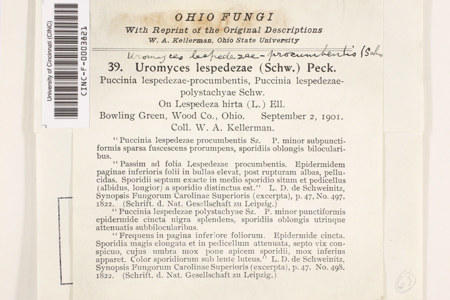
evidence. Museums hold 660 specimens
collected within 10 miles of Floral Hall between 1893 and
1975: 620 Animalia, 28 Fungi, 9 Plantae, 2 Chromista, 1 Unrecorded. 12 distinct Species records are shown.
Collected by Allen, J. M., Angle, E. (Eric), B. BURGER and others. Each is a
physical object with a catalogue
number, and each entry opens the museum's record. This is what was
collected and kept, not a survey of what lives here - nothing can be
concluded from a species being absent.
Regional context, not property-specific
evidence. The federal mineral resources record lists
1 working within 5 miles of Floral Hall: 1 plant.
All of them still produce. What was taken out: Stone, Crushed/Broken. Distance is straight-line from the
map coordinates, so a quarry counted here may appear on a neighbouring
settlement's page as well.
Regional context, not property-specific
evidence. The National Weather Service names
Bowling Green, the town this property stands in, in 64 storm reports between 1995 and 2024: 37 thunderstorm wind, 24 hail, 2 flash flood, 1 lightning.
The reports record 1 injury. Each account below is quoted exactly as the forecast office
filed it, from the NOAA Storm Events Database, and each date
opens the federal record of that event.
Lightning stuck a tree at a golf course in Bowling Green causing the tree to fall and land on a golf cart. A person riding on the golf cart was pinned and had to be cut out. The person was transported to a hospital for treatment of their injuries.
A line of severe thunderstorms moved across Wood County and caused widespread damage and power outages. A 101 mph wind gust was measured at the Bowling Green Airport at approximately 3:55 p.m. The airport, located on the northeast side of town, was very hard hit. The terminal building lost a large section of roof with three nearby hangers heavily damaged. A total of 17 aircraft were either damaged or destroyed. Four buildings at the Bowling Green State University were damaged by the strong winds. Signs and a press box on the campus were also toppled. Many other homes and buildings, including a city garage, were damaged. Hundreds of trees and limbs were downed and many streets had to closed because of debris. Dozens of vehicles sustained varying amounts of damage.
A trained spotter measured a 65 mph thunderstorm wind gust. Dozens of trees were toppled or snapped and three semi trucks were blown over on Interstate 75 just south of U.S. Route 6. No injuries were reported.
Dozens of trees were downed across Wood County. A few of the trees damaged homes. A tree punctured the roof of a home on Euler Road west of Bowling Green.
Thunderstorm winds estimated to be in excess of 60 mph blew a semi truck over on Interstate 75 ten miles north of Bowling Green. A car was also damaged.
Members of the public estimated wind gusts in excess of 70 mph west of Bowling Green. Many trees were downed from strong thunderstorm winds throughout Bowling Green and south to Portage. At least two of the trees fell on homes.
No historic map-sheet match is published
for this property yet. That does not mean no map exists. This record needs
a coordinate-quality review before it can be joined to a sheet boundary.
Browse the county's mapped places while that work is
pending.
From the nomination file
2,871 words on record
When this property was proposed for the
National Register, someone wrote the case for it: what the building is,
and why it matters. That document is a federal record in the public domain.
It is quoted below word for word, never summarised. The text was read off the scanned case file by machine, so the
occasional stray character is the recogniser's and the 1970s
typewriter's.
Description of the property
shutters.The northeast wall features a large single opening, like the cross sections.The main roof is an eight-sided applied to its facade and doors.It hasa brick foundation a center pole which is connected from the apex of the roof to a with some stone, and a wooden water table.The ends of each - good Floral Hall is octagonal in shape, highlighted by a Greek date Cross which is formed by extending equidistantly four of the placedboards both on.and above each door.There are louvered 8.
Statement of significance
(in one paragraph) Bowling Green as a picnic shelter in City Park. X1800-1899 1900- In l952 the Wood County Fair moved to a new site, about Tontogany in l882.-The first fair was held at this site in - archeology-prehistoric - community planning - landscape architecture - religion X architecture Builder/Architect Unknown 1600-1699 exploration/settlement x philosophy 9.
Quoted from the National Register nomination
for reference 82003666, 24 pages, held by the National Archives in Record
Group 79. See the
catalogue record.
Listed places nearby
3 within 8 miles
Other National Register properties close
enough to walk or drive between, ordered by distance from this one. Both
positions come from the same geocoding pass that matched these properties
to their map sheets.
Listing record. National Park Service National Register of Historic Places, listed-properties dataset, current to 2026-05-22.
Map join. Address geocoded through the United States Census geocoder, then tested against the published boundary of every sheet in the USGS Historical Topographic Map Collection.
How this page is made. Listing fields come from federal records; map-sheet coverage is a labelled coordinate-to-boundary calculation, not a source-field claim.
Wildfire. Short, Karen C. 2022. Spatial wildfire occurrence data for the United States, 1992-2020 [FPA_FOD_20221014]. 6th Edition. Fort Collins, CO: Forest Service Research Data Archive. https://doi.org/10.2737/RDS-2013-0009.6 Collected with United States Government funding and usable without additional permissions or fees.
Specimens. Global Biodiversity Information Facility (GBIF), https://www.gbif.org/. Only records licensed CC0 or CC BY are used. Records licensed CC BY-NC are excluded because this site carries advertising. Images are checked individually and any whose licence is non-commercial, no-derivatives or unreadable is refused.
Mines and quarries. USGS Mineral Resources Data System (MRDS) https://mrdata.usgs.gov/mrds/ A work of the United States government, no copyright under 17 U.S.C. 105.
Storms. NOAA National Centers for Environmental Information, Storm Events Database https://www.ncei.noaa.gov/stormevents/ A work of the United States government, no copyright under 17 U.S.C. 105. Narratives are quoted verbatim from the National Weather Service report and are not edited or summarised.
 Block
Block